House Ownership and Family Relations in Jewish Medieval Winchester
a GIS case study
The objective was to visualise the urban distribution of a clearly defined and well-documented minority group.
Information on house ownership can be found in Keene's "Survey of Medieval Winchester". Street naming is taken from Biddle's "Winchester in the Early Middle Ages" and seems to have been fluid. Keene reports that deed documents often refer to the same streets with varying names. Interestingly, in the 1280s, Alwarnestret became known as Fleshmongerstret (later St Peter Street), whereas the road formerly known as Flesmangerestret became Parchment Street - from this he concludes a westward migration of the butcher's trade.
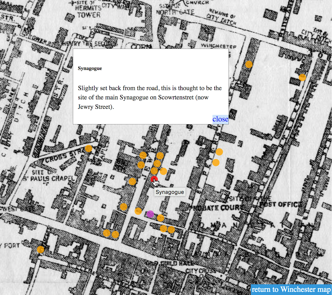
Carpenter Turner writes that Jews could not have lived from money lending alone and specifically mentions goldsmiths. Keene alludes to Jewish property in Goldestret, which could suggest that Jewish goldsmiths lived along this road. Other areas such as Little Minster Street and Tower Street are also reported, possibly because of their connection with trades associated with Jews - even though these locations do not appear in the actual survey. A proximity to the Gaol, Synagogue or Cemetery was considered as a safe place to live, due to the walled properties of these places.
All this needs to be treated with caution: it is not always clear who is related to whom, whether a person owned just one property in that street which they lived in themselves, or whether the property was let out. However, Bartlet's book on Licoricia of Winchester gives an invaluable insight into one particular family's relationships. Further researching all relationships and visualising these in addition to the housing locations would be a useful expansion of the case study.
For some ground photos, see my Picasa page. Biddle's work is especially useful for street name typonomy and its excellent maps of 12th-century street layout, overlaid onto 1976 council plans.
usage
This is the first and only map I created using CSS on an image map with a jQuery zoom effect. Back in 2010 it was quite fun to build, but nowadays this would be a bit tedious (let's not mention the rather unscientific approach to placing decorative dots on the image of a map scan). There are now jQuery plugins and libraries such as LeafletJS that will do this in a much easier way.
Click the blurred area to zoom to the city centre. Hover over the coloured circles to see an information label and click to open the info box.
- orange: references to specific Jews
- red: significant Jewish institutions
- blue: interesting finds
- purple: other locations of interest
Unfortunately the interactive map is currently unavailable.
© 2010
sources:
Suzanne Bartlet, ed. Patricia Skinner (2009): Licoricia of Winchester - Marriage, Motherhood and Murder in the Medieval Anglo-Jewish Community.
Martin Biddle (ed.) (1976): Winchester in the Early Middle Ages.
Barbara Carpenter Turner (1962): The Jewish Community in Medieval Winchester; article series in the Hampshire Chronicle.
Derek Keene, with Alexander Rumble (1985): Survey of Medieval Winchester.